FAA record × aerial reality

Rhode Island: where the heliport map and the ground disagree.

12
facilities checked
8
flagged for review
-
visitors

Data: FAA Airports (ArcGIS open layer)  |  Imagery: USGS NAIP (public domain)  |  AI vision: Claude Opus 4.8  |  built 2026-07-05

This is a prioritized review queue, not a list of findings.

A flag means a pad could not be confirmed from current imagery - never that a heliport is missing, fake, or mislocated. Help us check: vote on each one below.

Verdicts
7 Not visible1 Uncertain4 Confirmed
Facilities — worst-first
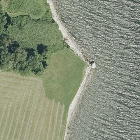
Aerial tile for 29RINot visible

29RI Vaucluse Farm

PORTSMOUTH, RI

41.5421666670001, -71.2355277779999

Center is a grassy shoreline meeting water with no prepared pad or markings visible.

85% confidence Verify on the map →
Is there really a pad here?
Aerial tile for RI08Not visible

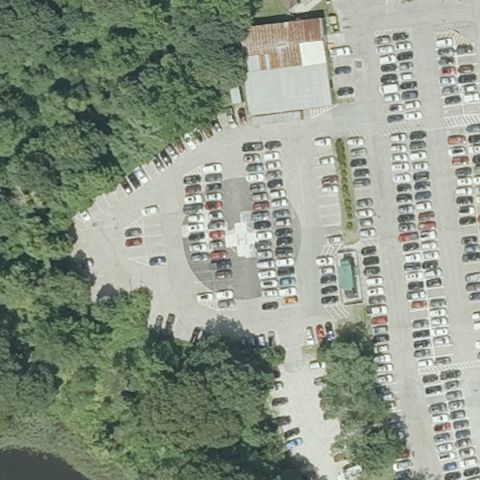
RI08 South County Hospital

WAKEFIELD, RI

41.4306583330001, -71.498052778

Center is an ordinary parking lot with no helipad markings.

80% confidence Verify on the map →
Is there really a pad here?
Aerial tile for RI30Not visible

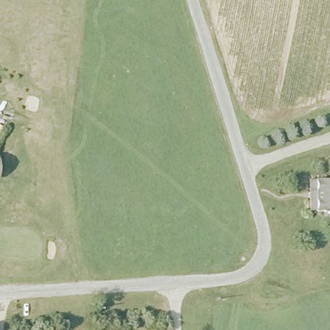
RI30 East Arnolda Farm

CHARLESTOWN, RI

41.378712222, -71.641173333

Center is an open grass field with no pad or markings.

85% confidence Verify on the map →
Is there really a pad here?
Aerial tile for RI02Not visible

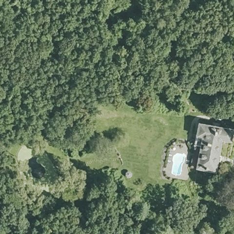
RI02 Grayrock Ridge

CUMBERLAND, RI

41.949311111, -71.415397222

Center is a forested clearing with no prepared pad visible.

85% confidence Verify on the map →
Is there really a pad here?
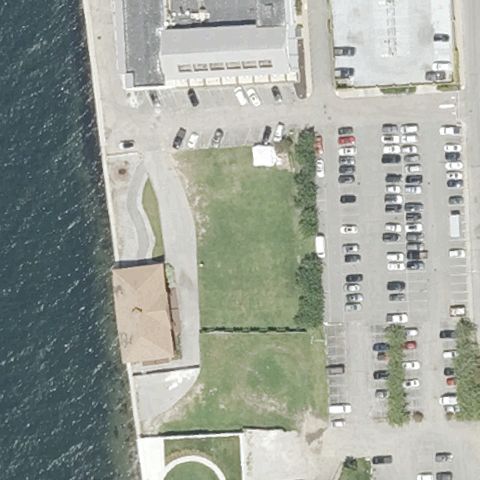
Aerial tile for RI21Not visible

RI21 Goat Island

NEWPORT, RI

41.490152778, -71.3278999999999

Center is a waterfront grass field with no clearly marked landing pad.

70% confidence Verify on the map →
Is there really a pad here?
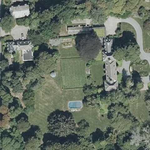
Aerial tile for 40RINot visible

40RI Newport Trust

NEWPORT, RI

41.4614444440001, -71.307666667

Center is the manicured lawn/garden of an estate with no distinct landing pad.

80% confidence Verify on the map →
Is there really a pad here?
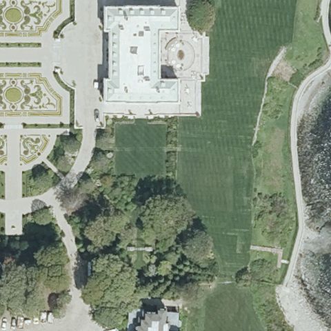
Aerial tile for 02RINot visible

02RI Miramar Residence

NEWPORT, RI

41.457931, -71.304886

Center is a mansion lawn with no prepared pad or markings visible.

80% confidence Verify on the map →
Is there really a pad here?
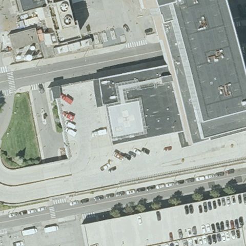
Aerial tile for RI25Uncertain

RI25 Rhode Island Hospital

PROVIDENCE, RI

41.810180556, -71.409469444

Center shows generic hospital rooftops and parking with no clearly distinguishable touchdown marking; a rooftop pad may be obscured.

50% confidence Verify on the map →
Is there really a pad here?
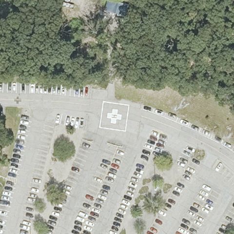
Aerial tile for RI01Confirmed

RI01 Kent County Meml Hospital

WARWICK, RI

41.707244444, -71.477502778

A marked touchdown pad with a white cross/H is visible on paved ground near the image center.

✓ Confirmed by AI vision with Claude Opus 4.8

85% confidence Verify on the map →
Is there really a pad here?
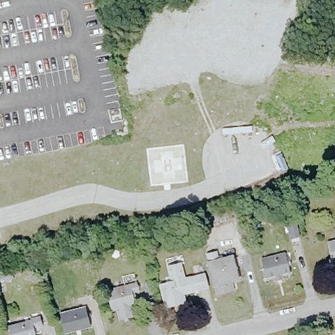
Aerial tile for RI23Confirmed

RI23 Westerly Hospital

WESTERLY, RI

41.3623916670001, -71.822308333

A light-colored prepared square pad is visible on the ground near the center of the image.

✓ Confirmed by AI vision with Claude Opus 4.8

70% confidence Verify on the map →
Is there really a pad here?
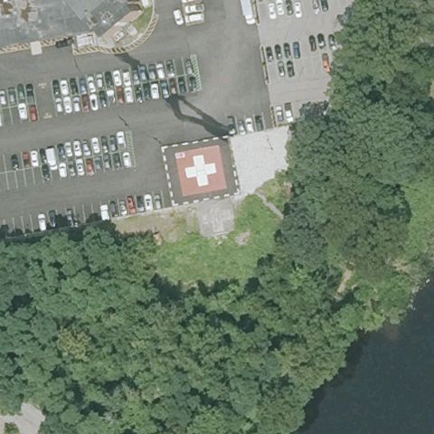
Aerial tile for RI26Confirmed

RI26 Landmark Medical Center

WOONSOCKET, RI

42.0036250000001, -71.4950249999999

A distinct touchdown pad with a red-and-white cross marking is clearly visible at the image center.

✓ Confirmed by AI vision with Claude Opus 4.8

90% confidence Verify on the map →
Is there really a pad here?
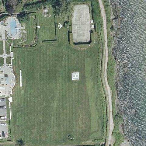
Aerial tile for 75RIConfirmed

75RI Hopedene, LLC

NEWPORT, RI

41.4804, -71.297122222

A small light-colored H/square marking is visible on the lawn near the image center.

✓ Confirmed by AI vision with Claude Opus 4.8

60% confidence Verify on the map →
Is there really a pad here?